tech2 News StaffSep 08, 2020 18:12:26 IST
A palaeontologist based out of California has designed an interactive map with various cities around the world as they were located 750 million years ago, before the continental drift carried continents further away from one another. This was also just around the time the first algae is thought to have evolved in the world’s oceans.
Created by former Google employee Ian Webster, the Ancient Earth map features a range of tools to explore different aspects of life on Earth over significant periods in history – for instance, where the earliest reptiles lived or when the first flower bloomed.
The app makes use of data from an existing map (called the PALEOMAP), with geological models for the movement of tectonic plates over 750 million years. PALEOMAP was produced by geologist and palaeogeographer Christopher Scotese. The map also uses a software called GPlates, used by geologists to visualize reconstruction and data from the movement of tectonic plates over geological time.
“My software ‘geocodes’ the user’s location and then uses (Scotese’s) models to run their location backwards in time,’ Webster told CNN. “I built the interactive globe visualization and the geocoding and GPlates integration myself so that people could plug in their own locations.”

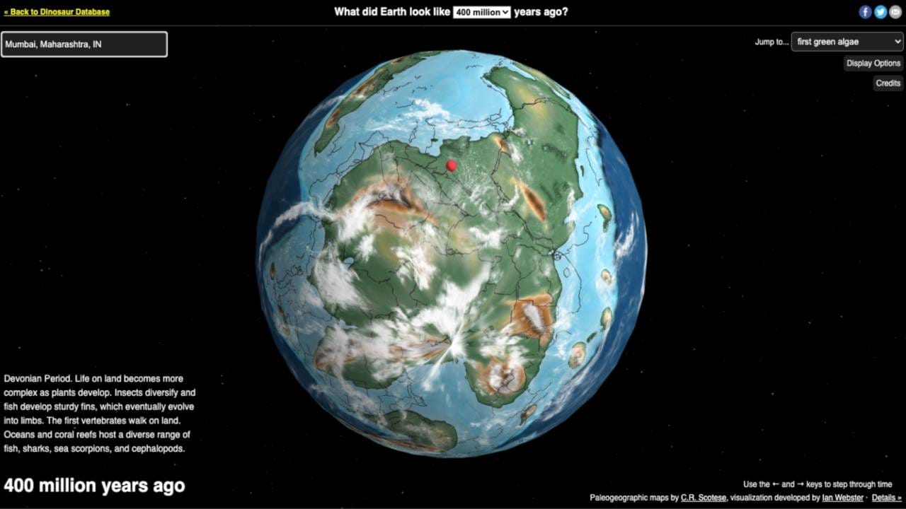
Mumbai’s location highlighted with a red pin in the interactive map, at 400 million years ago. Image: Webster
Webster’s intention was to make complex scientific data accessible in an easy-to-use format for teachers, parents or anyone keen on understanding the Earth’s history.
The map has interactive elements that allow users to change the year – anywhere from 750 million years ago till modern day (today) – and pin a place of your choice in the map.
“It shows that our environment is dynamic and can change,” Webster, added. “The history of Earth is longer than we can conceive, and the current arrangement of plate tectonics and continents is an accident of time. It will be very different in the future, and Earth may outlast us all.”
Every significant time point also shows information on key developments during that period.
Post a Comment