tech2 News StaffNov 13, 2019 19:03:24 IST
The Indian Space Research Organisation (ISRO) has released new images showing the different terrains on the lunar surface. These images were captured and prepared by the Terrain Mapping Camera-2 (TMC-2) that is currently onboard the Chandrayaan 2 Orbiter.
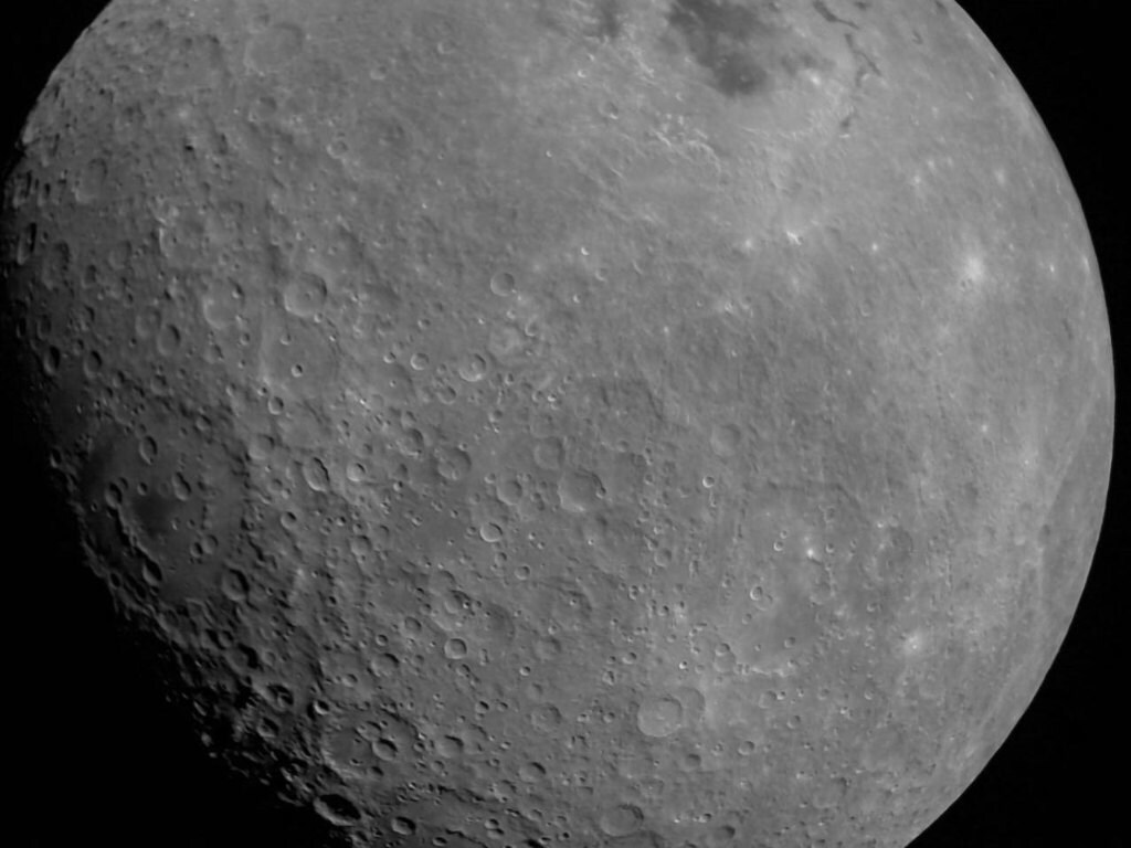
First photo of the moon from Chandrayaan 2. Image: ISRO.
The TMC-2 is the successor of the TMC that was present on the Chandrayaan-1 mission. It’s capable of taking images from a distance of 100 km while orbiting. Images are captured by a stereo triplet system where different images are captured in three separate views including ‘fore’, ‘nadir’, and ‘aft’. These images are combined to generate a Digital Elevation Model or DEM of the entire lunar surface.
#ISRO
Have a look of 3D view of a crater imaged by TMC-2 of #Chandrayaan2. TMC-2 provides images at 5m spatial resolution & stereo triplets (fore, nadir and aft views) for preparing DEM of the complete lunar surface.For more details visit https://t.co/urlZqzg3Gw pic.twitter.com/VBvUeH1L8s
— ISRO (@isro) November 13, 2019
The DEMs are capable of mapping various types of surface morphologies including craters, lava tubes, rilles (furrows formed by lava channels or collapsed lava tubes), Dorsa or Wrinkle ridges (formed mostly in Mare regions depicting cooling and contraction of basaltic lava), Graben structures (depicts the structural dislocations on the lunar surface) and lunar domes.
By enabling the capture of this data, ISRO can potentially reconstruct the morpho-structural framework by estimating the dimensions of the above landforms. Impact geometries can be derived from characterising craters and Crater Size-Frequency Distribution (CSFD) methods can be applied to determine surface age. Rheological analysis can be carried out as well based on the derived morphometric parameters and the lunar reflectance can be estimated among other things.
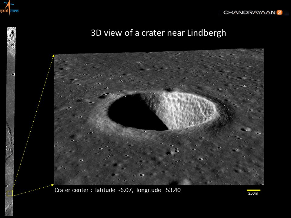
3D images of a crater created by the Terrain Mapping Camera-2 on the Chandrayaan 2 Orbiter. Image: ISRO
Previously, ISRO had announced the detection of Argon-40 in the lunar exosphere. Before that, it had released images of illuminated images and data from the Orbiter’s infrared instruments.
After an uncomfortably long silence, the Indian Space Research Organisation (ISRO) had released images and the first scientific data from the Chandrayaan 2 mission, which is survived by the Orbiter. Captured by the Orbiter’s High-Resolution Camera (OHRC) from an altitude of ~100 km, ISRO shared that the images are the highest resolution visuals ever taken of the Moon.
The mission’s lander Vikram and rover Pragyan, which crash-landed on the Moon during a soft-landing attempt on 7 September, continue to be incommunicado with ISRO.
<!–
Special Thursday Expiry on 10th 7th Nov
Early Closure to The Great Diwali Discount
Last Chance to get Moneycontrol Pro for a year @ Rs. 289/- only
Coupon code: DIWALI.
–>
Post a Comment